The largest country in Africa, spanning the Mediterranean coast, the Tell Atlas, the High Plateaus and the vast Sahara.
- Coordinates
- 28.034, 1.660
Explain Algeria through time and where to see each era.
Algeria History is one of Algeria Compass's 16 content clusters: From prehistory and Numidia through Rome, Islam, the Ottomans and independence. It connects 65 knowledge-graph entities with 8 page(s) and links to 13 related clusters.
The largest country in Africa, spanning the Mediterranean coast, the Tell Atlas, the High Plateaus and the vast Sahara.
UNESCO World Heritage Site (inscribed via list ref 102) in Al, Algeria.
UNESCO World Heritage Site (inscribed via list ref 179) in Tassili, Algeria.
UNESCO World Heritage Site (inscribed via list ref 191) in Djémila, Algeria.
UNESCO World Heritage Site (inscribed via list ref 193) in Tipasa, Algeria.
UNESCO World Heritage Site (inscribed via list ref 194) in Timgad, Algeria.
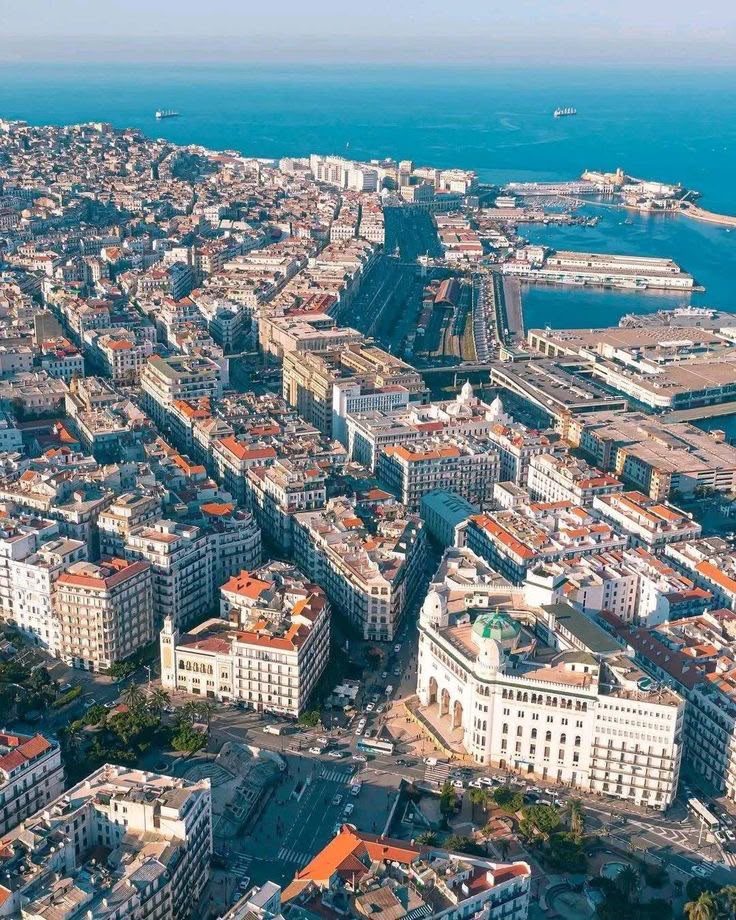
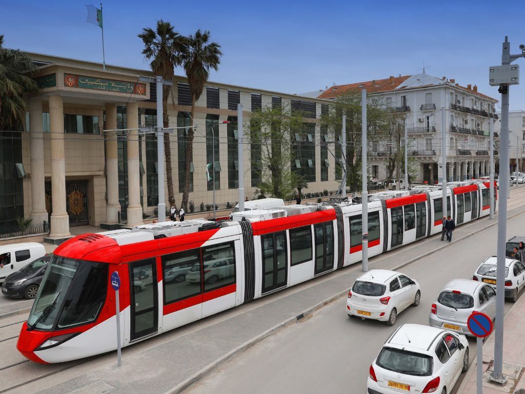
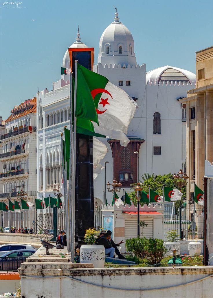
Algiers (El Djazaïr) is Algeria's capital and largest city — a Mediterranean port famous for its UNESCO-listed Ottoman Casbah, white tiered waterfront, French-colonial boulevards, the vast new Great Mosque of Algiers, and grand monuments like Notre-Dame d'Afrique and the Maqam Echahid. It's the country's main gateway and a city best explored on foot, with a guide for the Casbah.
Sétif is a highland province in north-eastern Algeria, best known for Djémila — one of the world's best-preserved Roman cities and a UNESCO World Heritage Site since 1982. It sits at around 1,100 m on the High Plateaus, has a cool four-season climate, the cedar forests of Babor, the landmark Ain El Fouara fountain, and a defining place in Algeria's road to independence.
The Casbah of Algiers is the city's historic Ottoman citadel and old town — a steep maze of whitewashed houses, palaces, mosques and covered lanes overlooking the bay. A UNESCO World Heritage Site since 1992, it is best explored on foot with a local guide.
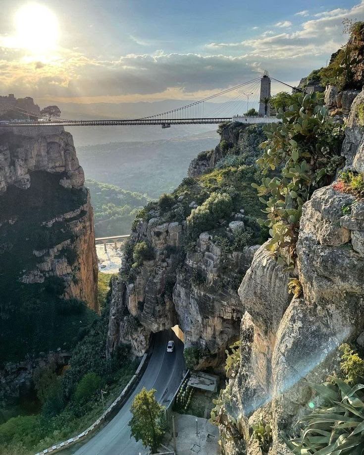
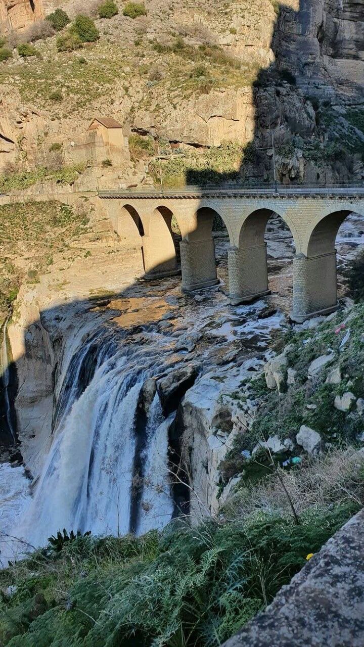
Constantine is the 'City of Bridges', a dramatic highland city in north-east Algeria built across a deep gorge above the Rhumel River and spanned by spectacular bridges. It is one of the oldest continuously inhabited cities on earth.
Djémila, ancient Cuicul, is one of the best-preserved Roman cities in the world and a UNESCO World Heritage Site since 1982. Set on a mountain spur in Sétif province, it preserves temples, forums, a theatre, the Arch of Caracalla and outstanding mosaics.
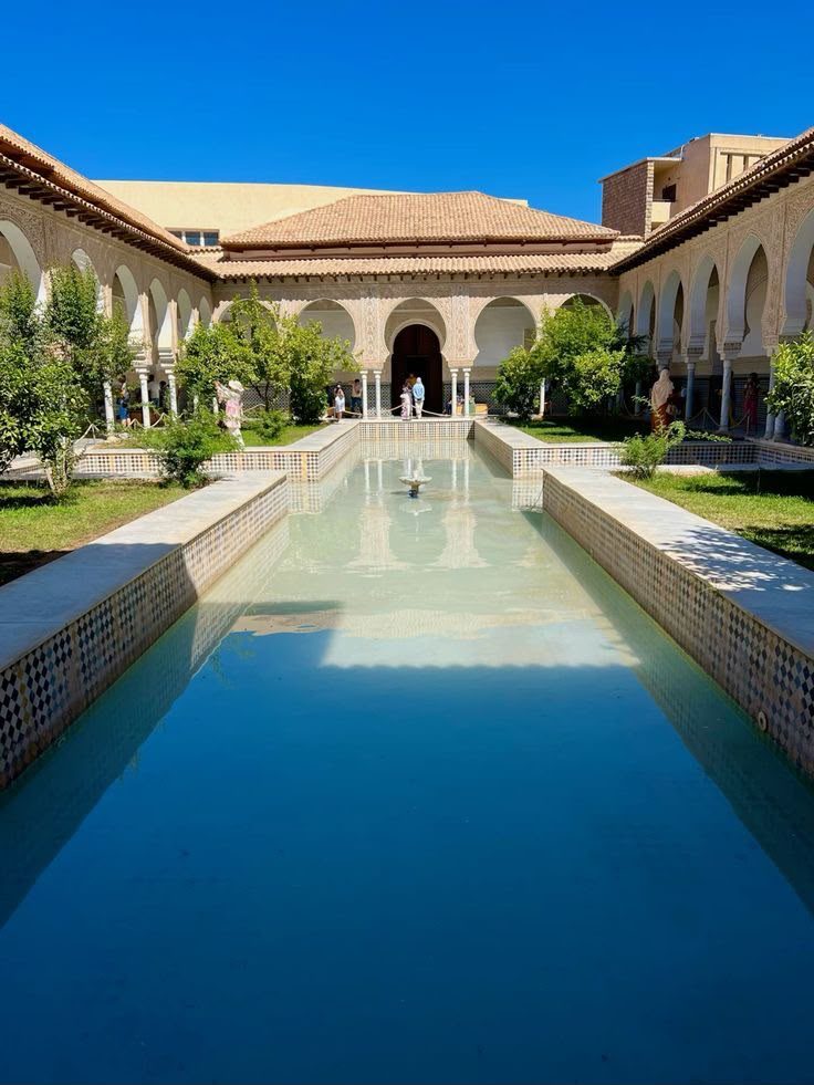
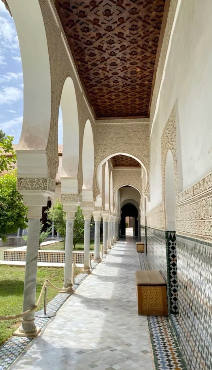
Tlemcen is a historic city in north-west Algeria, the country's great centre of Andalusian and Islamic heritage — famous for the Great Mosque, the ruins of Mansourah, and refined Hispano-Moorish art and music.